

Descripción
¡El plugin de mapas de Google Maps, Leaflet y Open Layers más fácil de usar (incluye un bloque de mapa)!
Anteriormente WP Google Maps.
Añade un mapa de Google personalizado, bloque de mapa o localizador de tiendas a tus entradas y/o páginas de WordPress de forma rápida y sencilla con el shortcode proporcionado. Sin complicaciones. Sin iFrames y ¡súper fácil de usar! Perfecto para mapas de página de contacto, rutas, mapas que muestran áreas de entrega y cualquier otro uso que puedas imaginar.
¡Mientras que la versión gratuita de WP Go Maps te permite crear un mapa de Google con tantos marcadores como quieras, la versión Pro te permite hacer mucho más!
¡Crea mapas de Elementor, bloques de mapa y widgets de mapa fácilmente con nuestra integración de bloque de mapa de WP Go Maps para Elementor, directamente desde la caja!
¿Usas el editor clásico? Seguimos admitiendo widgets de mapa para instalaciones clásicas de WordPress. No necesitas comprometerte, ¡el widget de mapa incluye la misma funcionalidad que nuestros bloques de mapa!
La versión WP Go Maps Pro te permite crear mapas de Google personalizados con marcadores de alta calidad que contienen ubicaciones, descripciones, imágenes, categorías, enlaces e indicaciones.
Versión Lite (gratuita)
- El plugin de mapas más popular para WordPress
- Elegir entre Google Maps, Leaflet, Azure Maps, Stadia Maps, Maptiler, LocationIQ, Zero Cost o Open Layers Maps
- Súper fácil de usar, no se requiere programación.
- Crear tantos marcadores de mapa como necesites simplemente escribiendo la dirección
- Mapas adaptables
- Bloque de mapa de Elementor
- Editar tus marcadores de mapa con un solo clic
- 9 temas de mapa populares para elegir
- Crear o añadir tu propio tema de mapa
- Arrastrar marcadores de mapa a una ubicación exacta
- Añadir un bloque de mapa a tu página
- Google Maps Streetview compatible
- Compatibilidad con caracteres UTF-8
- Funcionalidad de widget de mapa
- Funcionalidad de mapa en pantalla completa
- Compatible con la localización
- Elegir entre cuatro tipos de mapas de Google: mapa, relieve, satélite e híbrido
- Definir tu propia anchura, altura y nivel de zoom para tu mapa
- Añadir animaciones a tus marcadores de mapa.
- Funcionalidad de localizador de tiendas
- Restringir una búsqueda del localizador de tiendas por país
- Añadir polígonos a tu mapa
- Añadir polilíneas o rutas a tu mapa
- Crear un mapa en menos de 30 segundos.
- Hacer clic con el botón derecho para añadir un marcador a tu mapa
- Sin publicidad ni enlaces
- Autocompletado de Google Maps
- Capa de transporte de Google Maps
- Establecer el nivel de zoom máximo para tu mapa
- Servir los datos de tus marcadores de mapa a través de tu base de datos o un archivo XML
- Compatible con plugins de caché
- Compatible con Cloudfare
- Última API de Google Maps
- Última API de OpenLayers
- Última API de Leaflet
Edición profesional
- Crear múltiples mapas.
- Permitir a tus visitantes obtener indicaciones hasta tus marcadores.
- Añadir descripciones, enlaces e imágenes a tus marcadores de mapa.
- Añade categorías a los marcadores de tu mapa
- Filtrar marcadores por categoría
- Combinar múltiples mapas
- Bloques de mapa avanzados
- Bloque de mapa de localizador de tiendas
- Bloque de mapa de indicaciones
- Bloque Infowindow
- Bloque de mapa (filtro)
- Añadir diferentes iconos de marcadores, o tus propios iconos, para que tu mapa realmente destaque.
- Mostrar tus marcadores de mapa de cuatro formas: lista básica, tabla básica, carrusel, tabla avanzada
- Permitir a los visitantes usar su ubicación en el mapa como punto de inicio o de destino para las indicaciones
- Elegir entre la ventana de información predeterminada de Google Maps y la nueva ventana de información moderna
- Exportar o importar tus marcadores a un archivo CSV para editarlos rápidamente.
- Vincular tablas de Fusion a tus mapas de Google
- Mostrar la ubicación de tu visitante en el mapa
- Importar archivos KML/KMZ a tu mapa
- Opciones más avanzadas para el localizador de tiendas
- Permitir a los usuarios usar su ubicación en el mapa para el localizador de tiendas
- Búsqueda en el localizador de tiendas por categoría
- Ocultar todos los marcadores del mapa hasta que se realice una búsqueda en el localizador de tiendas
- Mover tu lista de marcadores dentro de la ventana del mapa
- Funcionalidad de múltiples widgets de mapa
- Añadir iconos de marcadores de mapa preparados para retina
- Compatible con redes de WordPress
- Obtén la edición profesional de WP Go Maps
Traducciones
¡Obtén una copia gratuita de la versión WP Go Maps Pro a cambio de traducir nuestro plugin!
- Inglés – por defecto
- Ruso (Alexandra Bondareva)
- Alemán
- Francés (Arnaud Thomas)
- Polaco (Michal Kotnowski)
- Finés (Johanna Joutti)
- Holandés (Jan Wind)
- Hebreo (Gal Dotan)
- Danés (Patrick Jepsen)
- Italiano (Tommaso Mori & Massimo Bregani)
- Croata (Sven Kopun)
- Griego (Konstantinos Koukoulakis)
- Rumano (Cosmin Stroe)
- Español (Carmelo Villegas Cruz)
- Portugués (Jose Antonio Ribeiro)
- Portugués brasileño (Roberto Costa)
- Turco (Suha Karalar)
- Sueco (Martin Sleipner)
- Búlgaro (Lyubomir Kolev)
- Indonesio (Neno)
- Lituano
- Checo
^El archivo de idioma debe actualizarse
Demos
WP Go Maps Lite
- Mapa de Google básico con marcadores
- Localizador de tiendas
- Polígonos y polilíneas/rutas
- Capa de tránsito de Google Maps
- Capa de tráfico de Google Maps
- Capa para ciclistas de Google Maps
WP Go Maps Pro
- Mapa de Google con marcadores avanzados
- Listas de marcadores – Simple
- Listas de marcadores – Avanzado
- Direcciones de Google Maps
- Mapa adaptable
- Categorías de marcadores (Filtrado)
- Localizador avanzado de tiendas
- Editor de mapas WP Go (Capturas de pantalla del back-end)
- Marcadores generados por visitantes – (Extensión WP Go Maps VGM)
- Estilos personalizados para mapas (Extensión WP Go Maps Gold)
Documentación
- Instalar WP Go Maps
- Crear tu primer mapa
- Añadir un bloque de mapa a tu página o entrada
- Combinación de mapas de Google (Pro)
- Exportar e importar marcadores de mapa (Pro)
- Cambiar el idioma de Google Maps
- Crear un mapa de Google y un marcador usando campos personalizados (Pro)
- Ver toda la documentación
Diagnóstico
Capturas





Bloques
Este plugin proporciona 2 bloques.
- Store Locator WP Go Maps Store Locator block, allowing to separate your store locator from your map
- Map The easiest to use Google Maps plugin! Create custom Google Maps with high quality markers containing locations, descriptions, images and links. Add your customized map to your WordPress posts and/or pages quickly and easily with the supplied shortcode. No fuss.
Instalación
Usuario de WP Go Maps por primera vez
¡Gracias por elegir WP Go Maps! Para crear tu mapa de Google, simplemente activa el plugin y haz clic en «Mapas» en tu menú de navegación izquierdo. Cuando se cargue la página de WP Go Maps, establece las opciones para tu mapa (altura, anchura, tipo de mapa, nivel de zoom, etc.) y luego usa tu ratón para arrastrar tu mapa de Google hasta la ubicación deseada y pulsa el botón «Guardar mapa». Copia y pega el shortcode en tu entrada o página y WP Go Maps creará automáticamente el mapa en tu página usando los ajustes que elegiste arriba.
Añadir tu primer marcador de mapa
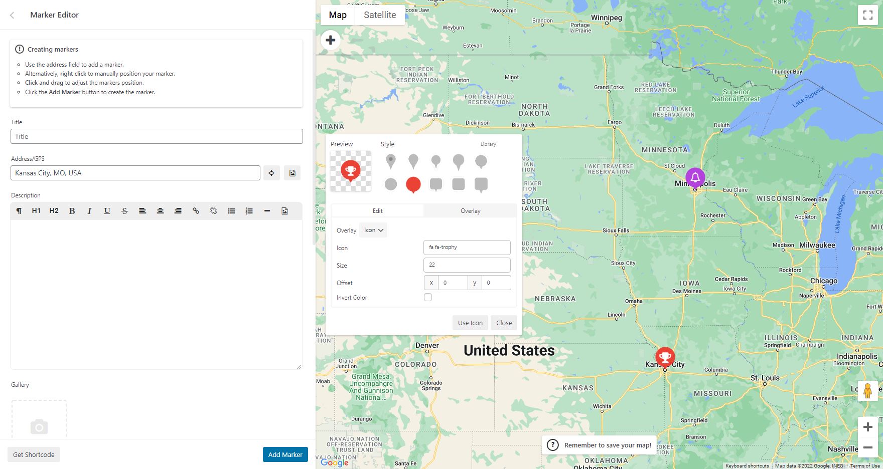
Para añadir un marcador a tu mapa de Google, desplázate hasta debajo del mapa en tu sección de administración e introduce la dirección o la ubicación GPS en el campo de entrada de dirección. Haz clic en «Añadir marcador» y WP Go Maps añadirá tu marcador a la dirección que especificaste.
Configurar un localizador de tiendas de Google Maps
Para usar la funcionalidad de localizador de tiendas de WP Go Maps, simplemente haz clic en la pestaña «Localizador de tiendas» en la página de creación del mapa y selecciona «Sí»
FAQ
-
¿Cómo consigo WP Go Maps Pro?
-
Simplemente visita https://www.wpgmaps.com y compra la edición profesional de WP Go Maps. Se incluyen actualizaciones y soporte gratuitos para siempre.
-
He instalado el plugin, ¿y ahora qué?
-
Una vez instalado y activado, debería aparecer un enlace en tu panel de navegación izquierdo dentro de la sección WP-ADMIN. Haz clic en el enlace «WP Go Maps» y sigue las instrucciones en pantalla.
-
¿Cómo pongo un mapa de Google en mi página o entrada?
-
Para mostrar tu mapa de Google personalizado en tu página o entrada, simplemente copia el shortcode proporcionado y pégalo en tu página o entrada. WP Go Maps configurará automáticamente el mapa con los ajustes que seleccionaste en la página de edición del mapa.
-
¿Cómo añado un bloque de mapa a mi página o entrada?
-
Es muy fácil añadir un bloque de mapa a tu página o entrada. Simplemente añade un bloque en el editor de páginas normal, luego escribe «Mapa» y deberías ver la opción de bloque de mapa. Para más información, consulta este tutorial
-
¿Cómo añado un widget de mapa a mi área de widgets?
-
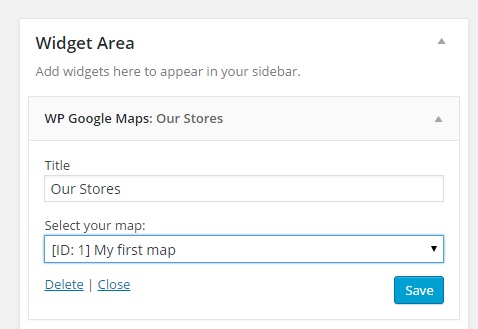
Para añadir tu mapa a tu área de widgets, simplemente ve a Apariencia > Widgets y arrastra el widget de mapa «WP Go Maps» a tu barra lateral. Luego edita el widget del mapa para que refleje el mapa correcto.
-
¿Necesito una clave API de Google Maps?
-
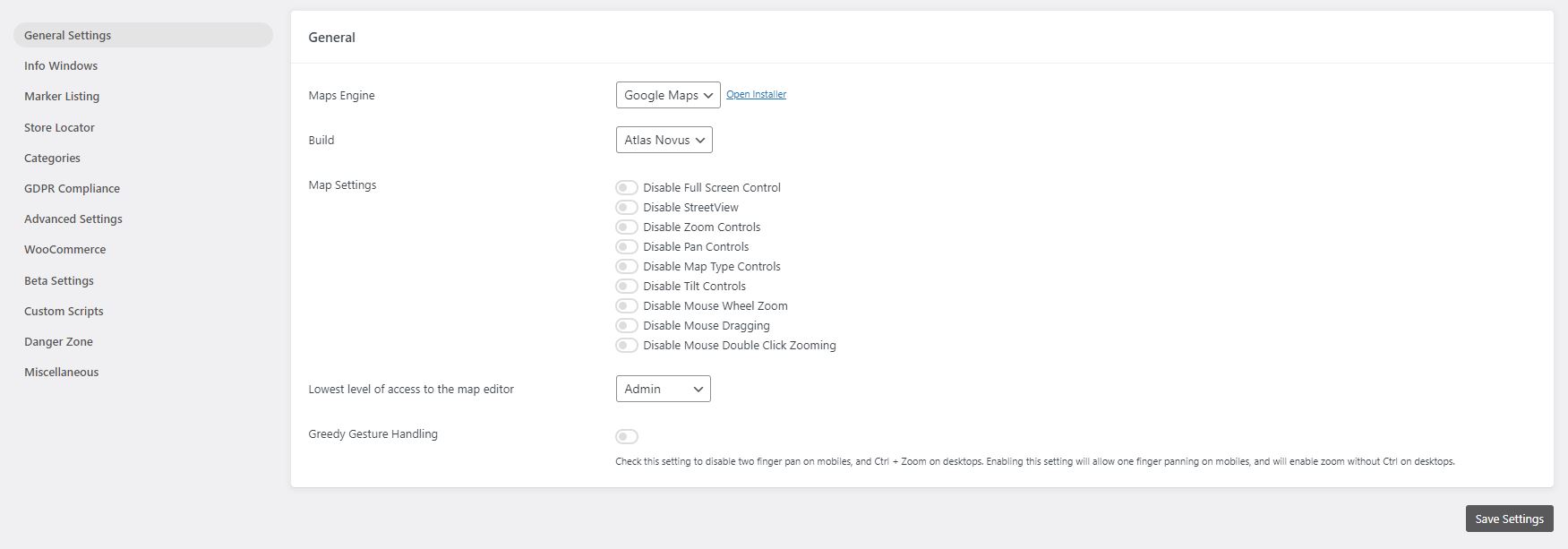
Solo si eliges Google Maps como motor de mapas. WP Go Maps también es compatible con Leaflet, OpenLayers, Stadia Maps, Maptiler, LocationIQ, Microsoft Azure y una opción Zero Cost, ninguno de los cuales requiere una clave API de Google. Puedes cambiar de motor en cualquier momento desde Mapas > Ajustes.
-
¿Qué motor de mapas debería elegir?
-
Si quieres los mapas nativos de Google y tienes una clave API, elige Google Maps. Si prefieres un motor que no requiera una clave API con facturación habilitada, Leaflet (teselas de OpenStreetMap) es una opción popular. También son compatibles OpenLayers, Stadia Maps, Maptiler, LocationIQ y Microsoft Azure. Zero Cost es una opción basada en Leaflet que no requiere configuración. La elección del motor no afecta a tus marcadores almacenados, por lo que puedes cambiar más tarde sin perder datos.
-
¿Por qué no se muestra mi mapa en el frontend?
-
Primero, confirma que el shortcode o el bloque se ha añadido correctamente a la página. Luego abre la consola de desarrollador de tu navegador y busca errores relacionados con el motor de mapas que estás usando. Si estás usando Google Maps, comprueba que la clave API en Mapas > Ajustes es válida y no está restringida a un dominio diferente. Los conflictos con temas o plugins también son comunes. Para obtener una guía completa de solución de problemas, consulta nuestra documentación de solución de problemas.
-
¿Cumple el plugin con el GDPR?
-
WP Go Maps no establece cookies de seguimiento y no transmite datos de visitantes a terceros más allá de las solicitudes de teselas de mapa y geocodificación necesarias para mostrar el mapa. El plugin incluye un aviso de consentimiento del GDPR integrado que bloquea esas solicitudes a la API hasta que un visitante las acepta. Configúralo en Mapas > Ajustes > GDPR.
-
¿Cuántos marcadores puedo añadir a un solo mapa?
-
No hay un límite estricto. La versión gratuita admite tantos marcadores como necesites añadir manualmente. La versión Pro añade importación masiva de CSV, categorías de marcadores, agrupación de marcadores y carga por lotes para sitios con miles de marcadores.
-
¿Funciona el plugin con Elementor, Divi, Gutenberg y otros constructores de páginas?
-
Sí. WP Go Maps incluye un bloque de mapa de Gutenberg, un widget de Elementor y un widget clásico de WordPress. El shortcode del mapa funciona en cualquier constructor de páginas que acepte shortcodes de WordPress, incluidos Divi, WPBakery, Beaver Builder y Oxygen.
-
¿Es compatible el plugin con WPML, Polylang y sitios multilingüe?
-
La versión gratuita está preparada para traducciones e incluye traducciones completas para francés, alemán, italiano, español y polaco, además de una cobertura parcial para muchos otros idiomas. WP Go Maps Pro añade compatibilidad con traducción dinámica para los campos de los marcadores (título, descripción, dirección) a través de WPML.
-
¿Puedo importar marcadores desde un CSV o una hoja de cálculo?
-
Sí, con WP Go Maps Pro. La herramienta de importación de la versión Pro acepta archivos CSV, KML y KMZ y admite importaciones por lotes para conjuntos de datos muy grandes. La versión gratuita solo admite la introducción manual de marcadores.
-
¿Es compatible el plugin con plugins de caché y Cloudflare?
-
Sí. WP Go Maps funciona con todos los principales plugins de caché, incluidos WP Rocket, W3 Total Cache y LiteSpeed Cache, así como Cloudflare. Si el mapa deja de cargarse después de activar una optimización agresiva (minificación o aplazamiento de JS), excluye los scripts de wp-google-maps de esas reglas y el mapa se mostrará correctamente.
-
¿Cómo puedo informar de errores de seguridad?
-
Puedes informar de errores de seguridad a través del programa de divulgación de vulnerabilidades de Patchstack. El equipo de Patchstack ayuda a validar, clasificar y gestionar cualquier vulnerabilidad de seguridad. Informar de una vulnerabilidad de seguridad.
Reseñas


Colaboradores y desarrolladores
«WP Go Maps – Google Map, OpenStreetMap, Leaflet Map» es un software de código abierto. Las siguientes personas han colaborado con este plugin.
Colaboradores


«WP Go Maps – Google Map, OpenStreetMap, Leaflet Map» está traducido en 25 idiomas. Gracias a los traductores por sus contribuciones.
Traduce «WP Go Maps – Google Map, OpenStreetMap, Leaflet Map» a tu idioma.
¿Interesado en el desarrollo?
Revisa el código , echa un vistazo al repositorio SVN o suscríbete al registro de desarrollo por RSS.
Registro de cambios
10.1.10 – 2026-09-28
- Fixed issue where the compressed marker ID buffer could be undersized for certain marker sets, causing the server to reject the request and marker searches to return no results. Thanks to Adamcengel
- Fixed issue where the compressed marker ID list could be corrupted when a large gap existed between filtered marker. Thanks to Mikael Føyen
- Fixed issue where event dispatcher may prevent event bubbling if an error occurs within the trigger call. Thanks to Mikael Føyen
- Updated built-in notices to disclose Pro V8 EOL to prevent confusion
10.1.09 – 2026-09-01
- Fixed issue where a crafted unauthenticated request to the compressed REST API parameter parser could trigger an unbounded loop, causing excessive CPU usage and log file growth (denial of service). Security issue, thanks to Asim Alshaya
10.1.08 – 2026-08-19
- Improved point label overlay offset manipulation system to be based on percentages instead of pixel values, this is more consistent across engines
- Improved Leaflet point label overlay to match Google and OpenLayers, where center-center is the standard
- Fixed issue where point label overlay placement would not be consistent across all engines, causing some variation with pixel placement
- Fixed issue where a translation in the cs_CZ language file was incorrectly utilizing a placeholder twice, causing a fatal error in the editor
10.1.07 – 2026-08-13
- Added extended data storage support in point labels to support feature expansion
- Added a new event trigger in MarkerFilter, ‘filteringstart’, which runs before a filter is about to start a run
- Added option to hoist script loading for environments that require early script loading
- Improved OpenLayers text overlays to be DOM based instead of canvas based, allowing element styling as part of a new styling module
- Improved modal serialization to ensure data is correctly serialized where needed, specifically addressing an issue with checkbox values not being serialized correctly
- Improved clarity of the theme JSON we support for Google Maps, specifically mentioning the requirement for legacy JSON not cloud based JSON
- Fixed issue where country restriction were not applied to all address providers, and as a result would provide wide results
- Fixed issue where Atlas Major marker list in editor would not correctly pull title/address from datatables request when system was in lazyload mode
- Tested with WP 7.1
10.1.06 – 2026-07-23
- Fixed issue where inactive map data would be served on direct /maps requests even if the map was not active. Security issue, thanks to Bao – BlueRock
- Fixed issue where individual datasets like /marker, /polygon and /polyline would be served even if the map was inactive. Security issue, thanks to Bao – BlueRock
10.1.05 – 2026-07-23
- Fixed issue where inactive map data would still be visible via the /features REST endpoint. Security issue, thanks to Bao – BlueRock
- Improved JSON encoding in the REST API response layer, using wp_json_encode instead of json_encode to ensure proper handling of multibyte characters and other edge cases. Thanks to Christopher Ross
- Updated installation module to enforce a 75/25 split between Atlas Novus and Atlas Major for new installations, as part of internal split testing.
10.1.04 – 2026-07-10
- Fixed issue where unauthenticated SQL Injection was possible via the limit paramater in the Marker Filter. Security issue, thanks to Jakub Herman
10.1.03 – 2026-06-17
- Fixed issue where the internal engine assignment could be skipped on fresh installs, defaulting new installations to Atlas Major instead of the intended random assignment
10.1.02 – 2026-06-15
- Fixed issue where unauthenticated requests could trigger unintended database writes via the DataTables REST endpoint. Security issue, thanks to Thanh Diem (Wordfence)
- Fixed issue where Datatables language files may not load correctly in some environments due to name case. Fallback system developed to resolve and fail gracefully if unavailable
10.1.01 – 2026-06-10
- Added a canonical POT translation template (languages/wp-google-maps.pot) so translators and contributors can generate and maintain language files from a single source rather than reconstructing the template locally each pass
- Added a fully complete French (fr_FR) translation, refreshed against the 10.1.00 codebase including all Atlas Major UI strings.
- Added a fully complete German (de_DE) translation, refreshed against the 10.1.00 codebase including all Atlas Major UI strings.
- Added a fully complete Italian (it_IT) translation, refreshed against the 10.1.00 codebase including all Atlas Major UI strings.
- Added a fully complete Spanish (es_ES) translation, refreshed against the 10.1.00 codebase including all Atlas Major UI strings.
- Added a fully complete Polish (pl_PL) translation, refreshed against the 10.1.00 codebase including all Atlas Major UI strings.
- Improved responsiveness of the map editor at narrow viewports (Atlas Major).
- Fixed issue where Leaflet frontend maps could place markers at incorrect pixel positions when the page layout had not finished settling at map construction time. An invalidateSize() call after first paint forces the origin to be recalculated against the correct container dimensions
10.1.00 – 2026-06-03
- Added Atlas Major, a new editor UI.
- Added live preview to the map editor, showing how the page will render with real-time updates as settings change (Atlas Major)
- Added automatic background save via REST. Form changes are persisted shortly after a change with a «Saved» indicator, falling back to a native form submit after 3 seconds if the REST request fails (Atlas Major)
- Added live tileset swap, applying a tileset to the editor map immediately on selection without needing to save (Atlas Major)
- Added click-drag isolation on info-window panels, directions boxes, and inner-stack overlays so panel interactions no longer drag the map underneath (Atlas Major)
- Added «Save & Reload» confirmation modal for settings that require a fresh map construction, with an in-progress overlay during the reload (Atlas Major)
- Added auto-scroll to top and address field focus after a successful Add Marker (Atlas Major)
- Added auto-close of info window panel after delete, and auto-refresh of info window content after a marker save (Atlas Major)
- Added store locator text override preservation across editor rebuilds (Atlas Major)
- Added 🔑 indicator next to engines in the engine switch dropdown that require an API key
- Added missing API key notice for Microsoft Azure, Stadia Maps, Maptiler, and LocationIQ. Previously only Google Maps would surface this notice
- Added auto-return to the feature list panel after a successful Add Marker or Add shape
- Fixed issue where saving the map in basic would write empty strings into Pro-only store locator visual fields, leading to invisible store locator circles after Pro was activated
- Fixed issue where info-window distance calculation read the wrong unit source, causing «miles away» labels to render kilometre values
- Fixed issue where the map list page displayed poorly on small screens due to DataTables 2 colgroup widths
- Fixed issue where the map editor REST autosave returned a 500 error under Pro because an admin-only file include was not available in the REST request context
- Fixed issue where the Plugin class __isset method was missing magic-getter cases, causing several live preview Pro template injections to silently fail (Atlas Major)
- Fixed issue where the custom image overlay live preview could corrupt the map start coordinates because the Leaflet CRS is locked at map construction (Atlas Major)
- Fixed issue where unchecked checkboxes were treated as enabled in live preview (Atlas Major)
- Fixed issue where the action bar Save Map and Preview buttons would wrap to separate rows on narrow sidebars (Atlas Major)
- Fixed issue where the bulk markers REST endpoint would return unapproved markers to unauthenticated users. Security issue, thanks to Fraudless.tech (Ilyess Ghalem)
- Improved default map height for new maps from 400px to 600px
- Improved Save Map button feedback to pulse red with a spinner during autosave and manual saves (Atlas Major)
- Improved engine switching from the editor toolbar to reload the editor so the new engine libraries load correctly
- Improved missing API key notice to render as a centered card over the map area
- Improved store locator radius circle cleanup when components rebuild in live preview (Atlas Major)
- Improved editor diagnostics by removing verbose console output on page load and save (Atlas Major)
- Improved internationalisation by auditing UI strings and migrating hardcoded text to WPGMZA.localized_strings (Atlas Major)
- Improved cursor handling across editor panels and info-window overlays so Leaflet’s grab cursor no longer leaks into UI surfaces (Atlas Major)
10.0.10 – 2026-05-13
- Fixed issue where Datatables AJAX fallback would bypass the approval filter. Security issue, thanks to WPScan, Jetpack, Automattic (Erwan)
- Fixed issue where single marker endpoint and AJAX fallback would bypass the approval filter. Security issue, thanks to WPScan, Jetpack, Automattic (Erwan)
- Fixed issue where Pro users below V10.0.06 would experience issues with admin marker tables, which do not have access to V2 library methods
- Fixed issue where Pro users below V10.0.06 would experience issues Google Drawing Manager, which is being deprecated in favor of an internal module
- Fixed issue where WPML users would experience failure in the settings area when running legacy UI
10.0.09 – 2026-04-16
- Fixed issue where minified code base was not accurately compiled due to issue with internal build tools. Only affected pro users
10.0.08 – 2026-04-16
- Fixed issue where users on Pro below V10 would experience a DataTables V2 init failure, preventing access to the map editor and marker list. When Pro below V10 is detected, DataTables V1.12 and its Responsive extension are now loaded from CDN instead
- Fixed issue where users on Pro below V10 would see an init failure on the map editor due to the Google Drawing Manager library not being loaded. The drawing library is now injected into the Google Maps API URL via the compatibility layer when Pro below V10 is detected on the map edit page
10.0.07 – 2026-04-15
- Added methods to internal Google Drawing Manager, internalizing this feature, and allowing removal of native Google Drawing Manager. Due to upcoming deprecation
- Added scale line control support for Google Maps, Leaflet, and OpenLayers. Can be enabled on a per map basis
- Added ability to override plugin language from within the settings. Defaults to site language
- Added ability to override custom tile server token field name
- Added ability to override custom tile server type (raster or vector)
- Added native Elementor integration with Map and Store Locator widgets, mirroring the existing Gutenberg block structure
- Added ElementorModuleWidget abstract base class to provide a shared preview/render pattern for all Elementor module widgets
- Added support for WPML post type translations, ensuring integrated post type marker sources respect the active language
- Added blueprint JSON file to assets for preview mode support moving forward
- Fixed issue where script loader would throw a notice for Google vertex menu when not using Google Maps engine
- Fixed issue where Leaflet maps set to a starting zoom below 2 would cause incorrect marker placement due to EPSG3857 world-copy wrapping; a safe minZoom floor of 2 is now enforced for standard tile maps (custom tile/CRS.Simple maps are unaffected)
- Fixed issue where Astra Theme Compatibility layer may trigger an error on some environments
- Improved the language loader to ensure we don’t unexpectedly trigger a global language file due to missing files, as this leads to outdated translations
- Improved all datatables related styles to better support the V2 upgrade
- Updated FR translation files. Thanks to Madevcomfr
- Updated credits page to include new contributors and translators
- Updated internal process to ensure accurate version management (SVN)
- Updated DataTables to V2 release, and migrated core modules to support this change
- Updated WritersBlock internal library to add additional features
- Remove responsive DataTables extension as this is bundled in our V2 files
- Removed Google Drawing Manager as a dependency, in favour of internal module, which is being deprecated by Google
10.0.06 – 2026-03-17
- Fixed issue where nonce refresh actions were missing permission checks, creating an XSS vulnerability. Security issue. Thanks Nguyen Ba Hung (bashu) (KCSC) (Wordfence)
- Fixed issue where settings storage would rely purely on nonce checks, without reasserting permissions. Security issue. Thanks Nguyen Ba Hung (bashu) (KCSC) (Wordfence)
- Fixed issue where Google marker click event for AdvancedMarkerRender mode was set to ‘click’ instead of the suggested ‘gmp-click’
- Fixed issue where marker offset method would fail in Leaflet causing issues with NVC systems and other marker nudge modules
10.0.05 – 2026-01-14
- Fixed issue where notice actions were missing permission checks. Low level users could trigger actions like switching map engines. Security issue. Thanks Moose Love (Nagasaki Prefectural University) (Wordfence)
- Fixed issue where deferred loading with WP Rocket would lead to initialization error. We now exclude inline initializer and settings object from this system. Can be disabled in settings
- Fixed issue where batch marker loading would incorrectly trigger final shape fetch request
- Fixed issue where internal map library loaders would not respect force-load flag when enqueueing scripts
- Fixed issue with setMap calls on point labels
- Improved point label architecture to support regeneration and map ID changes if needed
10.0.04 – 2025-12-04
- Added pro features page and menu item
- Added additional page construction hooks
- Added demo list to maps view page
- Added LocationIQ to engine swap toolbar
- Improved PHP 8.5 stability & compatibility
- Fixed issue where engine swap toolbar would not set tileserver defaults for first time users
- Fixed issue where map list clicks were not being handled correctly for action buttons
- Fixed issue where PHP 8.5 would throw a deprecation warning due to an outdated switch case
- Fixed issue with our internal links, docs, site, support, forums, throughout the plugin
- Fixed issue where bulk marker selection button would not work in some environments
- Fixed issue where info-window link controls were available in basic
- Updated marker listing demo image
10.0.03 – 2025-11-27
- Added first time usage flow which opens the marker creator once for new users (UX Improvement)
- Added engine swap toolbar to map editor for first time usage, once dismissed does not show again (UX Improvement)
- Added a new setting to enable dynamic translations, as this must be an opt in for large data sites
- Updated internal CTA buttons and controls from gold to blue (UX Improvement)
- Removed a console log within the map initialization controller, it is not relevant with delayed loading
- Removed the disable dynamic translation, instead we now allow this via an opt in instead
10.0.02 – 2025-11-17
- Added shapes and overlays sub-section to map editor, moving all relevant datasets into that panel (UX Improvement)
- Added ability to click on a map from the map list to open the editor (UX Improvement)
- Added primary button color to edit map button within map list (UX Improvement)
- Added blue highlight to primary dataset creation buttons to make it clearer how to add datasets (UX Improvement)
- Added button to marker quick tip notice to jump straight to marker creation (UX Improvement)
- Added conditional checks for major version mismatches in compiler, preventing mismatched major versions from throwing build errors
- Added a one time hint tool to our internal map editor tour system, which will show helpful usage hints after the main tour is completed.
- Fixed issue where Google Maps logo would not display on some installations, within the engine selector
- Fixed issue where plugins that load bootstrap in our editor might cause editor placement issues, plugin conflict
- Fixed issue where map preview would not generate on some themes. We now generate a draft page, which is reused and pruned when new previews are created
- Moved save map notice in map editor to top anchor
- Moved add marker quick tip notice in map editor to bottom left anchor
- Removed bounds reset system when adding a marker to a map, to allow multiple markers to be added to the same region without reset
10.0.01 – 2025-11-10
- Fixed issue with compatibility layer for older versions of Pro add-on (V8 and below)
10.0.00 – 2025-11-10
- Added Leaflet engine support
- Added Azure engine, powered by Leaflet
- Added Stadia engine, powered by Leaflet
- Added Maptiler engine, powered by Leaflet
- Added LocationIQ engine, powered by Leaflet
- Added support for OpenLayers V10
- Added ability to use legacy (V6) OpenLayers, should be considered deprecated. Will be removed in the future
- Added ability to change address providers, for autocomplete and client side geocoding
- Added additional address providers including Google Maps, Azure Maps, Nominatim, LocationIQ and engine default
- Added ability to provide a supplementary address provider API key if needed
- Added ability to switch tile servers, with another from the same provider, on a per map basis
- Added additional tile server options, with providers and automated groupings
- Added ability to set line thickness on both rectangles and circles
- Added tile server previews for improved customization
- Added support for dynamic content translations with WPML
- Added Atlas Novus as the default internal build
- Added danger zone tool to reindex any spatial coordinate data for markers, where a spatial coordinate has gone missing
- Added ability to adjust rectangle boundaries with boundary input
- Added ability to bulk delete shapes
- Added ability to center on shapes and datasets within the editor
- Added dropdown context meny to shape datatables
- Added option to cachebust REST API requests
- Added improved GDPR styling, it becomes the new default
- Added quick delete button to info-window within the map editor
- Added ability to override any HTML template part via a child theme override
- Added map preview system, allowing maps to be previewed on frontpage
- Added default indexes to all tables to improve performance
- Added spatial indexes to tables where applicable to improve performance
- Added fullscreen map editor panel mode, for dataset listings, allowing more data to be viewed
- Added extended maximum zoom level (22) which is supported by all map engines
- Added mobile settings tab to editor
- Added ability to set a different map width/height for mobile devices
- Added new default engine/installer preset for zero cost mapping, for all new installations
- Added ability to reduce marker editor geocoder usage. Skips geocoding if lat/lng coordinates are present, opt in available in settings
- Added ability to select store locator button style (Icons (default), or Text) on a per map basis
- Added accessibility support, with the goal of being WCAG Level AA compliant
-
- Aria labels and roles added where needed
-
- Improved focus cues and managing of indexing
-
- Keyboard navigation added (tab, enter, space, and escape for panels)
-
- Hierarchy restructuring where needed to better support navigation
-
- Tested with various tools:
-
-
- Microsoft Accessibility Insights: Pass (FastPass)
-
-
-
- Axe DevTools: Pass (WCAG Level AA)
-
-
-
- Google Lighthouse: Pass (100% Accessible)
-
-
-
- Wave Tools: Pass
-
-
- Manual testing completed for navigation with a keyboard
-
- We will continue to improve this over time
-
- Known Issues
-
-
- Only supported on the frontend
-
-
-
- Does not allow marker selection via the map container (Marker listings supported, and encouraged for accessibility focused installations)
-
-
-
- Although a substantial rework has been implemented, this has not been verified by 3rd party compliance testers at this stage
-
-
-
-
- We know that accessibility is more nuanced than simple machine driven tests, we’d like to work with our community to ensure we improve this further
-
-
-
-
-
- Please reach out to us if you find anything that you feel should be improved as a priority!
-
-
- Improved internal autocomplete modules for better user experience and management
- Improved theme preset user interface
- Improved theme CSS editor
- Improved tile server system to handle params and authentication more efficiently
- Improved tile server system to properly attribute various service providers
- Improved settings user interface, adding sections and descriptors for better clarity
- Improved Google Maps Advanced Marker render mode support
- Improved Google Async support
- Improved zoom sliders within editor
- Improved map initialization state control
- Improved map initialization error correction
- Improved map initialization automatic delayed retry module
- Improved info-window open calls to include data-props in container for styling
- Improved styling system to allow native info-windows to inherit brand styling
- Improved open layers native info-window, now includes border radius and shadows
- Improved checkbox styling within the map viewport
- Improved available WP filters within our AjaxTable class, allowing count values to be filtered
- Improved internal shape architecture
- Improved batch loader logic and modularized method
- Improved welcome page to include new features
- Improved all option management by disabling autoloading, reducing impact on server resources
- Improved Legacy to Atlas Novus migration flow by introducing automatic map settings migration modules
- Improved DomDocument param handlers where needed
- Fixed issue where marker labels would not render & symbols correctly
- Fixed issue where major version mismatch would cause UI error to be thrown in REST API requests
- Fixed issue where shape datatables within the editor couldn’t be searched fully
- Fixed issue where touch events would not dispatch on OpenLayers shapes
- Fixed issue with error suppression in DomDocument class, added LIBXML_NOERROR when
- Fixed issue where some overlays would overlap info-windows in Open Layers (Example clusters)
- Fixed issue with clustering translations in DE language files
- Fixed issue where engine switch notice would show even if the user has already switched to Atlas Novus (manually)
- Moved build selection Danger Zone
- Moved optimization options out of beta
- Moved map mobile zoom level control to mobile panel section
- Removed Stamen Design tile servers, as they have moved to Stadia
- Removed OpenPtMap tile server due to missing SSL
- Removed duplicate map fetch methods, which were unused
- Archived V9 changelogs
For more, please view the WP Go Maps site.